
The risk has intensified this year, with continuous rain, flash floods, and landslides between 4 and 9 July killing 15 Rohingyas, injuring 18 others, and affecting 26,119 people across the camps, according to the latest update from the Rohingya Coordination Platform.
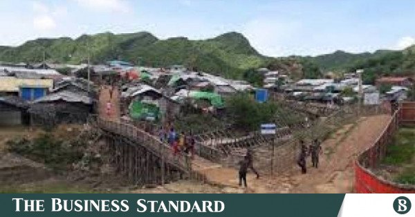
Rohinga Camp. Photo: Collected
“>

Rohinga Camp. Photo: Collected
Nearly 6,000 acres of hills and forests in Cox’s Bazar have been cleared to accommodate more than 1.1 million Rohingya people forcefully displaced from Myanmar, leaving camp settlements highly vulnerable to landslides that have killed at least 43 people and injured 98 since 2021.
The risk has intensified this year, with continuous rain, flash floods, and landslides between 4 and 9 July killing 15 Rohingyas, injuring 18 others, and affecting 26,119 people across the camps, according to the latest update from the Rohingya Coordination Platform.
Refugee Relief and Repatriation Commissioner Mohammad Mizanur Rahman told TBS that around 80% of shelters across the Rohingya camps remain exposed to landslide risks because the settlements were built on hilly forest land.

“Camp shelters are temporary. When risks emerge, residents are relocated and later return once conditions improve. The only permanent solution is repatriation,” he said.
According to UNHCR, Bangladesh currently hosts around 1.17 million Rohingya refugees, including about 1.14 million living in 33 camps in Cox’s Bazar. The refugees occupy around 220,000 shelters spread across nearly 24 square kilometers. Government policy requires all camp structures to remain temporary.
UNHCR data show that landslides in the camps killed at least 43 people and injured 98 between 2021 and 2026. The annual toll was eight deaths and 23 injuries in 2021; one death and five injuries in 2022; three deaths and 10 injuries in 2023; 12 deaths and 23 injuries in 2024; and two deaths and nine injuries in 2025. This year alone, 17 people have died and 28 have sustained injuries. This year, 17 people have died and 28 have sustained injuries.
The latest weather-related disasters have further worsened humanitarian conditions. Between 4 July night and 9 July noon, authorities recorded 95 landslides, 156 windstorms, and 21 flood incidents, totalling 286 weather-related events. The disasters temporarily displaced 4,307 people, partially damaged 2,809 shelters, and completely destroyed 13 others.
Supernumerary Professor Mohammad Kamal Hossain of the Institute of Forestry and Environmental Sciences at Chittagong University said the recurring landslides were not merely natural disasters but the result of environmental destruction and poor planning.
“Cox’s Bazar’s hills were once covered with dense forests. ” Deep-rooted trees and vegetation created a strong natural bond that stabilised soil and protected slopes from heavy rainfall,” he said.
He said indiscriminate deforestation to build refugee camps left hills exposed, allowing rainwater to penetrate loose sandy soil rapidly and trigger slope failures. Unplanned construction of shelters, schools, and madrasas across hill slopes without proper alignment further increased the danger.
A 2018 UNDP report, Impacts of the Rohingya Refugee Influx on Host Communities, estimated that the refugee influx destroyed about 4,818 acres of reserved forest worth around $55 million. Nearly 6,000 acres of government land containing forests and hills were used for refugee settlements, while large-scale hill cutting rendered about 5,000 acres of agricultural land unsuitable for cultivation.
The report also found that around 750,000 kilograms of firewood were collected daily for cooking, equivalent to clearing nearly four football fields of forest every day. The resulting environmental degradation increased risks from landslides, flash floods, and cyclones while destroying wildlife habitats and intensifying human-elephant conflict.
According to a 2022 World Bank Policy Research Working Paper, Cox’s Bazar lost around 12,808 hectares of forest between 2017 and 2020, nearly 20% of the district’s total forest cover. Forest cover inside Rohingya camps fell from 54% to just 2% during the same period.
The study said extensive deforestation and hill cutting for shelters and infrastructure weakened slope stability, accelerated soil erosion, and significantly increased the risks of landslides and flash floods during the monsoon. Although LPG distribution has reduced pressure on forests for fuelwood, settlements and infrastructure continue to pose environmental risks.
About The Author